RNSEUROPE
RNS Mission Control · Disaster response · Europe

One operational picture.
Every nation. Every organisation.
No infrastructure required.

RNS Mission Control connects civilian and military responders across borders on satellite, mesh and drone links that keep working when the networks are gone.

Talk to us See the system
● Satellite + mesh + drone● Encrypted end to end● EU data sovereignty● Proven from Antarctica to Norway
Proof · Not a concept

We took it from the ice to the mountains. It worked.

We did not design RNS Mission Control at a desk. We carried it to Antarctica, then into a tent camp in the Norwegian mountains, and we run real disaster data through it today. Every module on this page has been used outside a lab.

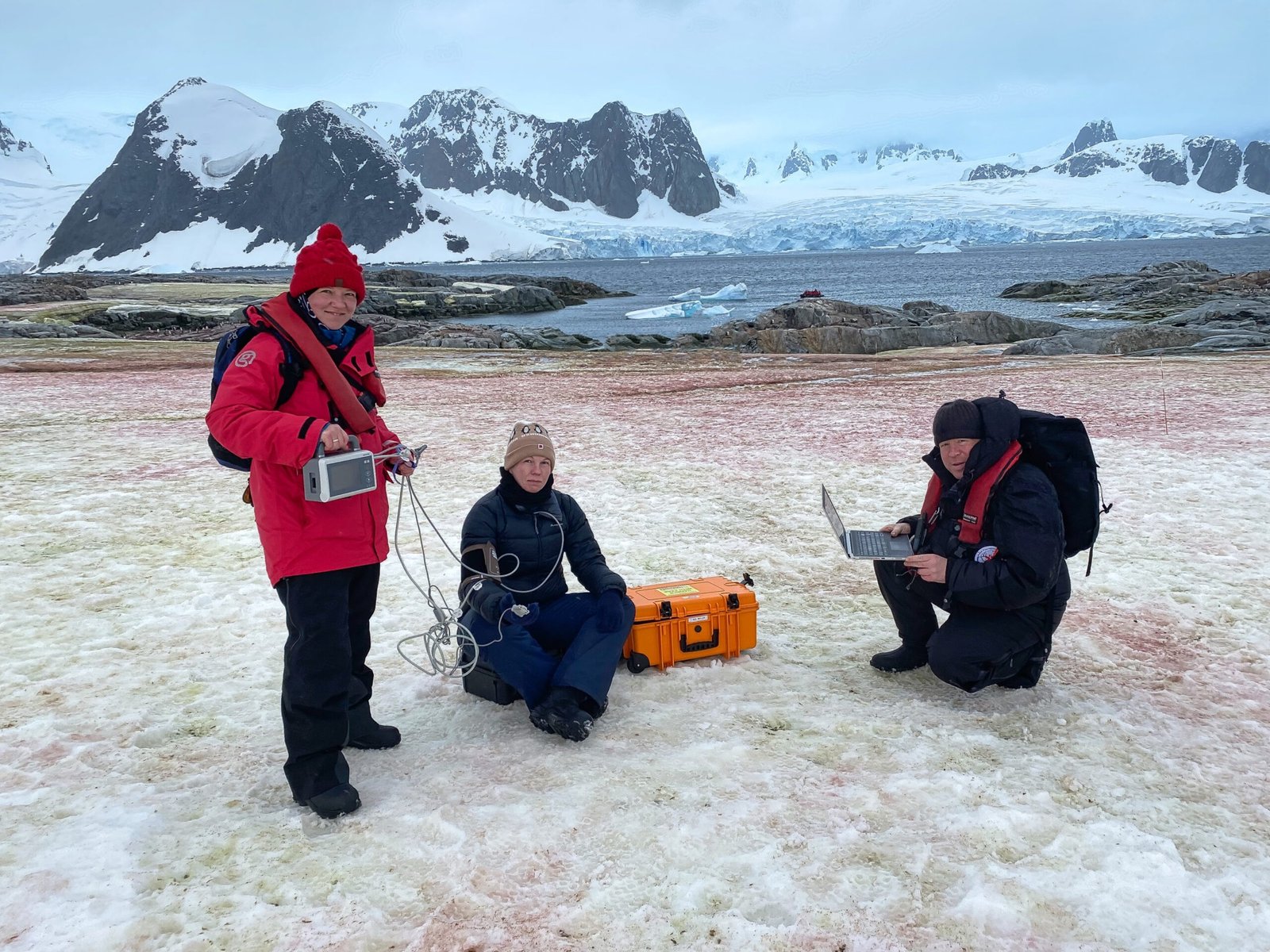
RNS team operating the system on the snow in Antarctica, 2024
01 · Antarctica · 2024

Telemedicine on a continent without infrastructure

The expedition team used LEO satellite communication for telemedicine for the first time, with clinical-grade monitoring and live consultation. The results were published in a peer-reviewed journal (Military Medicine, December 2024).

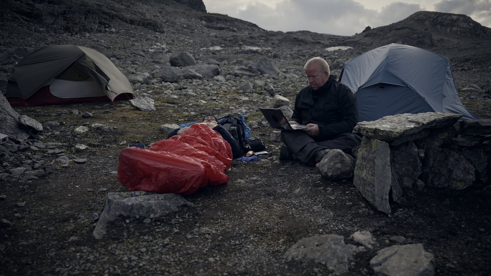
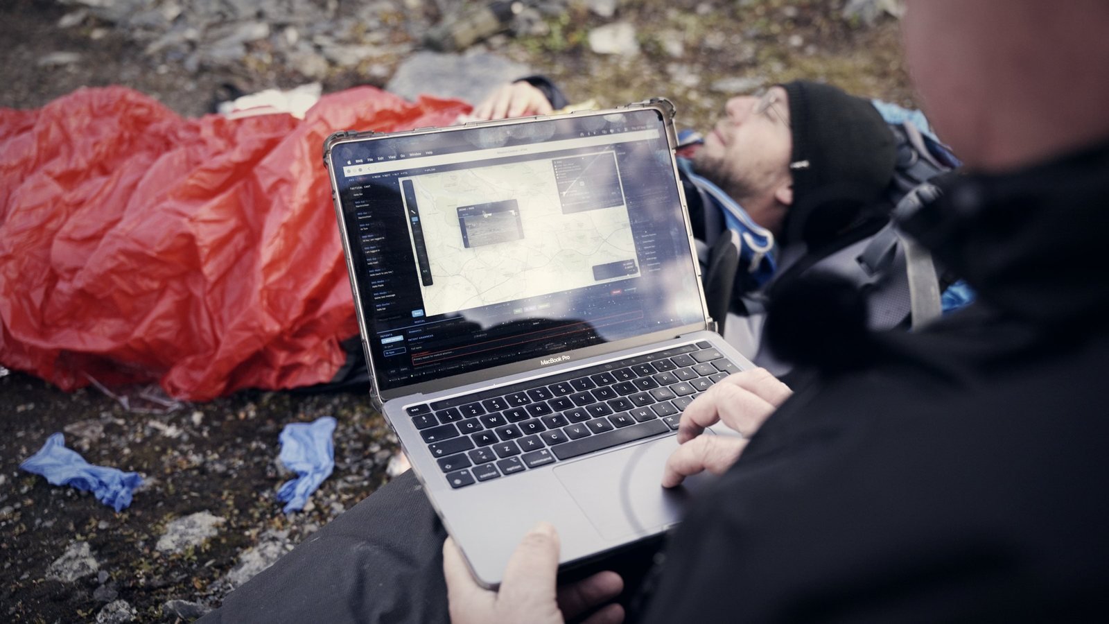
Field camp with two tents, a patient in a bivouac sack and an operator working on a laptop
02 · Norway · August 2026

A tent camp in the mountains

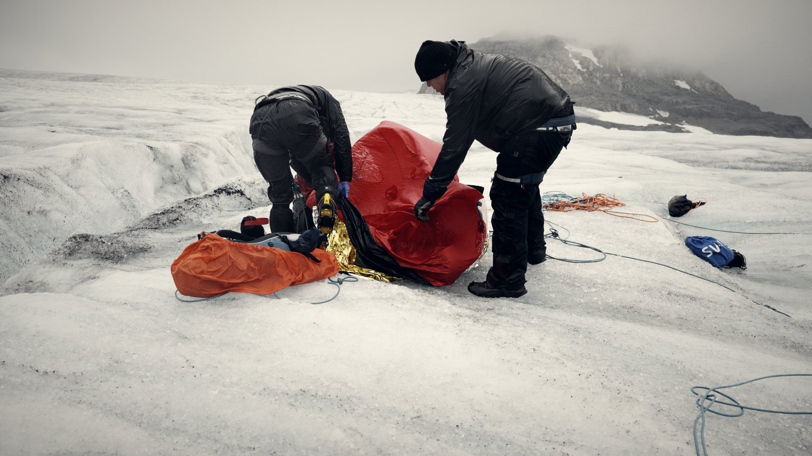
Laptops, patient monitors, drones and MANET radios ran together in the field, with casualty scenarios on a glacier as the workload. No mains, no towers, no cloud.

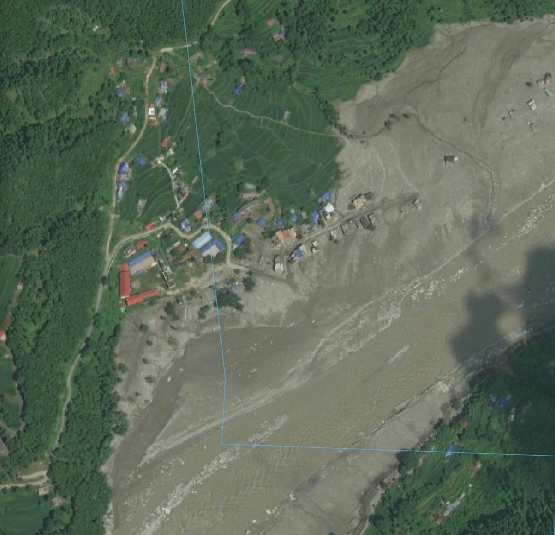
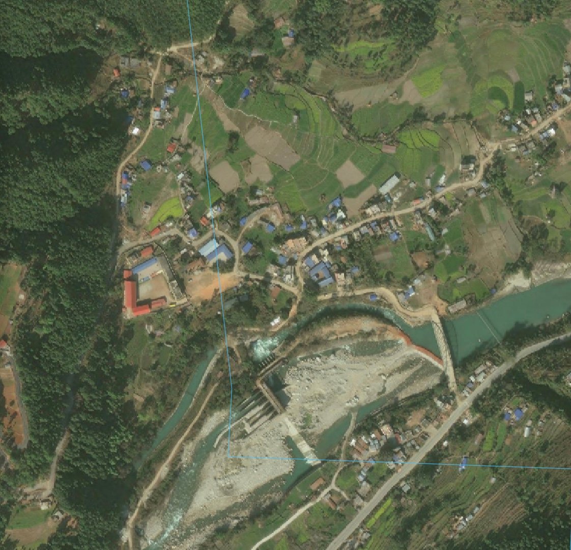
Satellite image of the Trishuli valley in Nepal after the flood, shown in RNS Mission Control
03 · Nepal · August 2026

A real flood, on the real map

The Trishuli flood was analysed in RNS Mission Control with satellite images from before and after the event, on the same screen the commander works with. We also made the app available to emergency responders in Nepal.

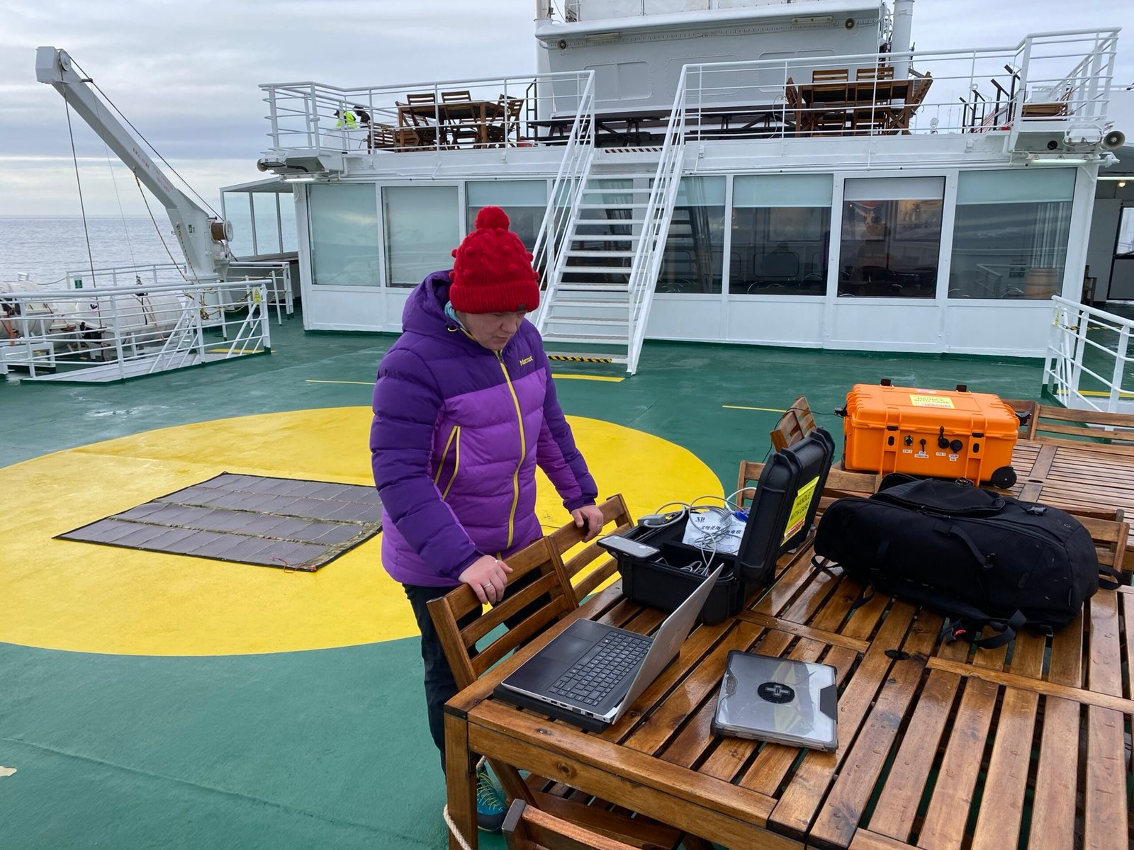
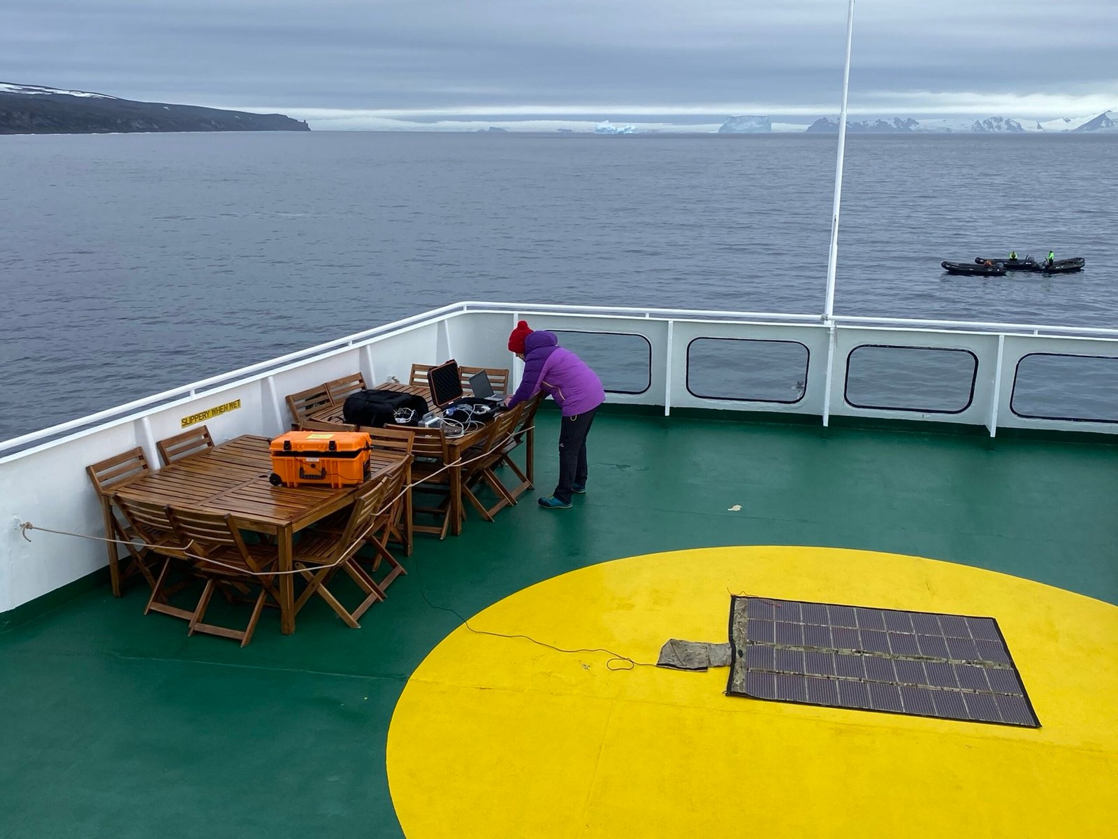
Rugged case with laptop on a ship's helideck in Antarctica
Antarctica 2024 · Field kit on the ship's deck
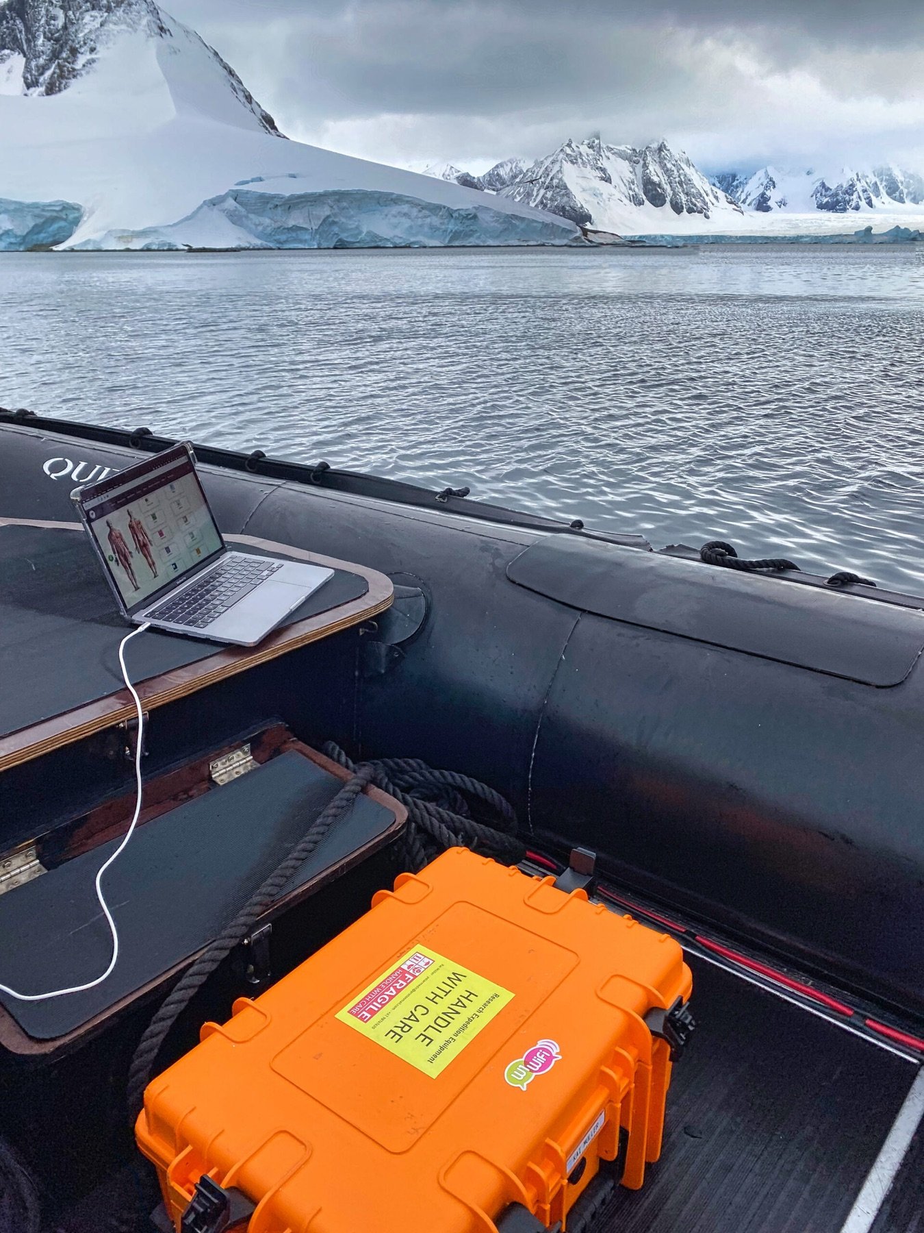
Rugged case and laptop in an inflatable boat among sea ice
Antarctica 2024 · Running from an inflatable boat
Operator at a field table on the helideck of an expedition ship
Antarctica 2024 · Telemedicine workstation on board
01 · What we deliver

Built for the first hours of a European disaster.

A

Multinational by design

UCPM and rescEU modules, NATO units and host-nation responders work on the same encrypted picture, across borders and across command structures.

B

Civil and military, one network

Paramedics, civil protection coordination centres, CIMIC teams, NGOs and military medics see the same map, the same patients and the same tasking.

C

Infrastructure-independent

Satellite uplink, self-healing mesh, airborne repeater and its own power. It runs where towers, mains and roads are gone.

Why RNS

Built for the place where large systems stop.

Large crisis-management platforms are designed for command centres with power, networks and IT staff. RNS is designed for the first hours, when none of that exists.

Typical large-scale systems
  • Rely on fixed or mobile networks, or on a single uplink
  • Need servers, licences and specialist staff on site
  • One tool per organisation, interfaces added later
  • Often hosted in a non-EU cloud
  • Demonstrated in exercises and trials
RNS Mission Control
  • Satellite, self-healing mesh and drones, combined
  • Operating in 15 minutes from one case, with its own power
  • One picture for civil and military responders from the start
  • EU sovereign, offline-capable, local storage
  • Used on an Antarctic expedition and in a Norwegian field camp
General comparison of typical approaches. No specific vendor is implied.
02 · RNS Mission Control

Command the scene. Monitor the patient. Task the teams.

Modular, so each organisation uses what it needs on a shared backbone.

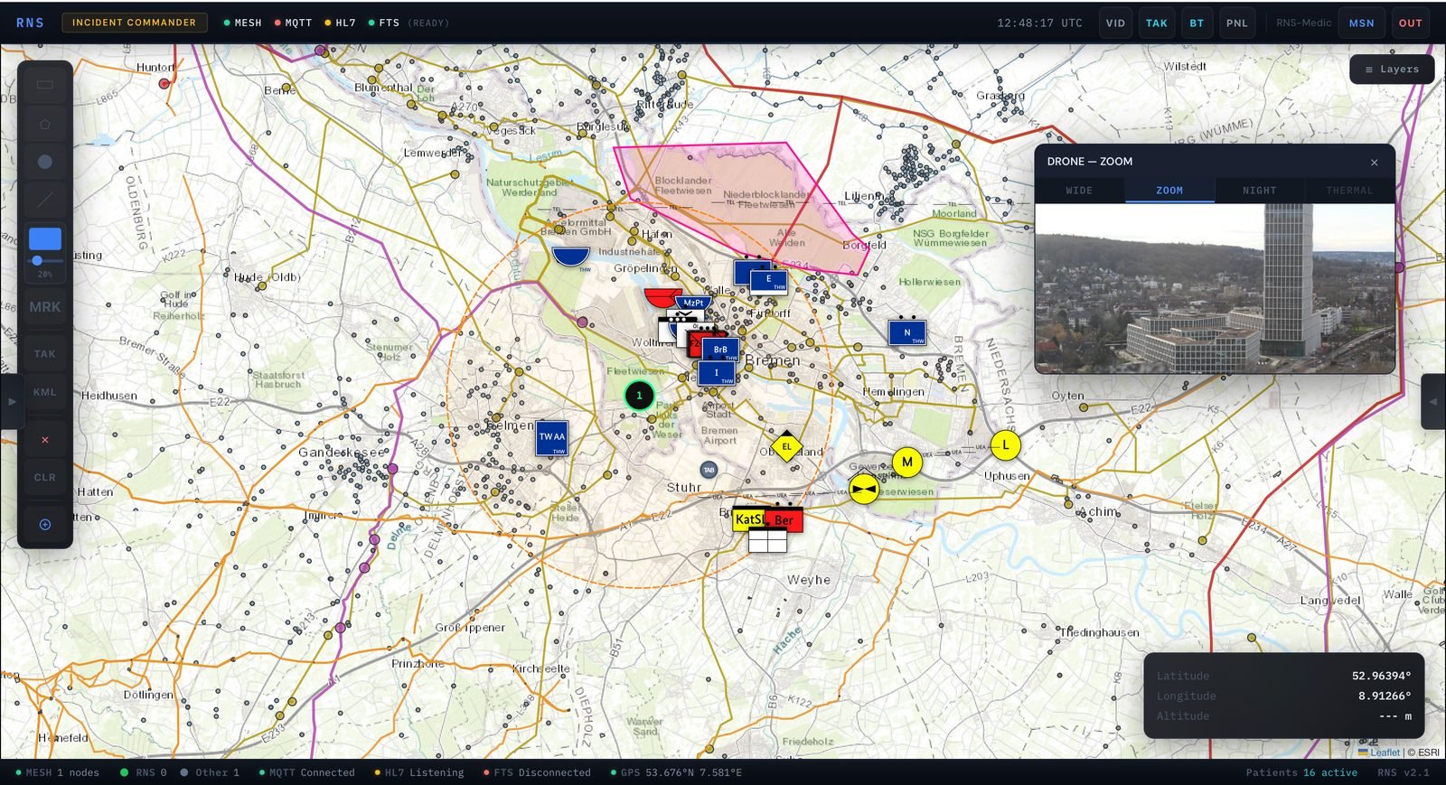
Incident Commander · Operational viewTest environment
RNS Incident Commander: tactical map with NATO symbology, polygon zone and drone feed panel
Map, drone feed and patient vitals on one screen, shared across the mesh in real time.
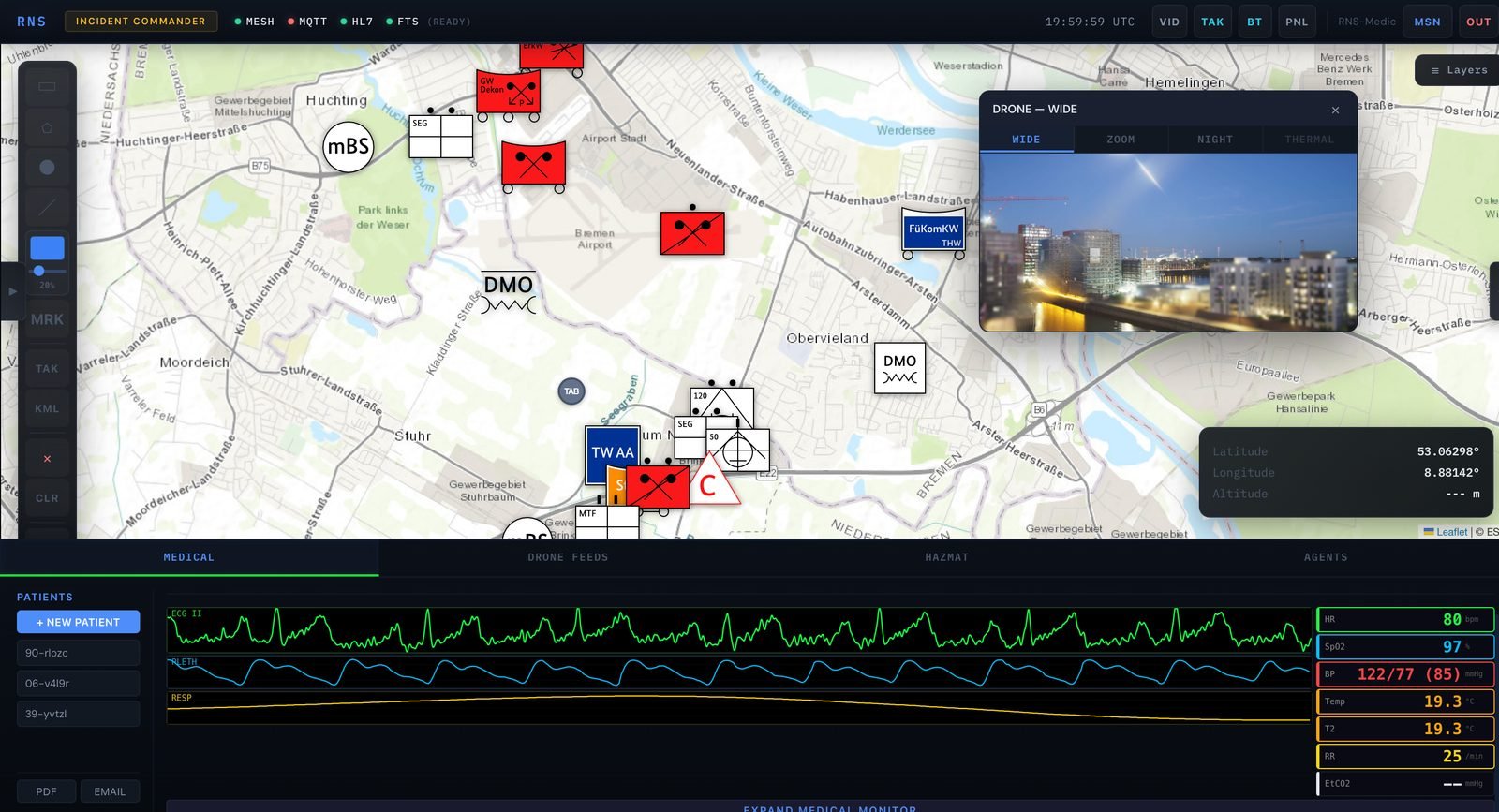
Medical tab · Live vitals
Incident Commander medical tab with ECG, SpO2, blood pressure and respiration under the tactical map
Patient vitals directly below the map. The commander never switches context.
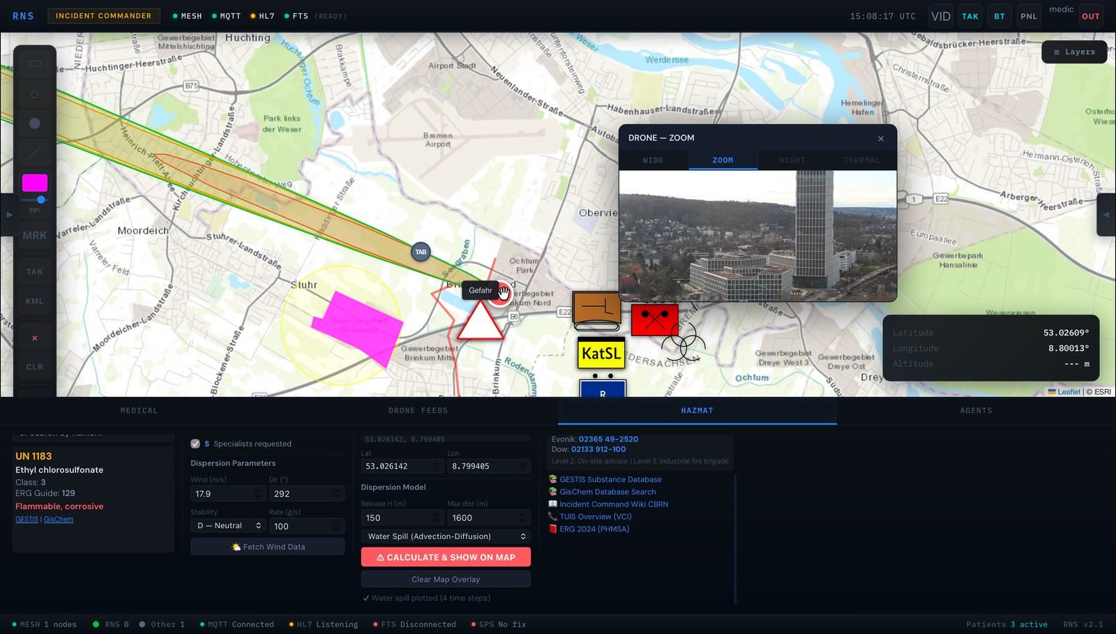
HAZMAT tab · Dispersion model
Incident Commander HAZMAT tab with UN substance lookup and dispersion plume on the map
Substance identified, plume modelled and shown on the map.
SITUATIONAL AWARENESS

Shared tactical picture

NATO symbology, forces, casualty stations and decontamination points placed by anyone, visible to everyone.

TELEMEDICINE

Multi-patient monitoring

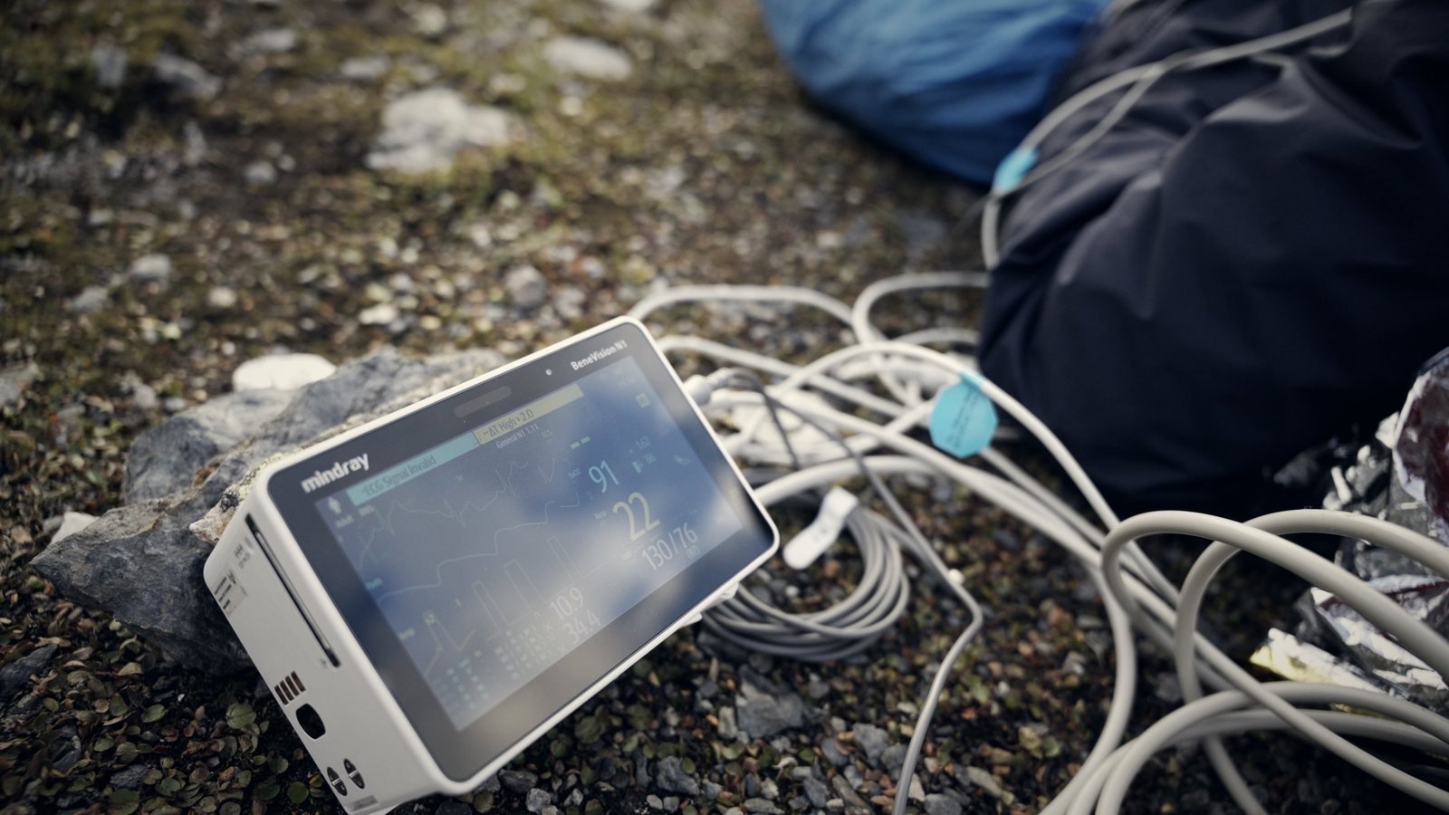
Live ECG, SpO₂, blood pressure and triage status per casualty. Native HL7 data from Mindray N1 patient monitors.

CBRN / HAZMAT

Substance to plume in minutes

UN and ERG identification, GESTIS and GisChem look-up, dispersion model with live wind and plume overlay, all offline on the mesh.

AIR

Drone feed and airborne relay

Wide, zoom, night-vision and thermal video, geo-referenced on the map. The same drone extends mesh coverage into dead zones.

MEDEVAC

9-Line, generated for you

Structured data capture, GPS grid coordinates and direct transmission to command.

FORCES

Tracking and tasking

Position, status and assignment of every responder, from first aid post to command staff, with encrypted tactical chat.

03 · Damage assessment

See the damage from orbit. Confirm it from the air.

RNS compares satellite images from before and after the event to show where the damage is, then sends drones to verify it on the ground. Responders get a prioritised picture instead of a search.

Before · Satellite
Satellite image of the Trishuli river in Nepal before the August 2026 flood
Trishuli river, Nepal · village, river and intake works before the flood · Esri World Imagery, Vantor Open Data
After · Satellite
Satellite image of the same spot on the Trishuli river after the flood, 8 September 2026
Same spot, 8 Sep 2026 · river bed buried in flood debris, village edge hit · Vantor Open Data, CC BY-NC 4.0
01

Compare

Satellite images from before and after the event are analysed to find damaged areas across the whole region.

02

Verify

Drones fly the flagged areas and send live video and thermal imagery back over the mesh for ground-level confirmation.

03

Prioritise

Confirmed damage appears on the shared tactical map, so every organisation sends teams to the same priorities.

04 · Infrastructure-independent

When the network ends, the mission does not.

The Solar Backpack carries the full stack: satellite uplink, mesh radios, drone integration, encrypted data link and a local server. Solar, wind and battery keep it alive across multi-day deployments, including below zero.

24h+
Autonomous, no external power
15 min
From case to operating network
−20 / +55
Operating range, °C
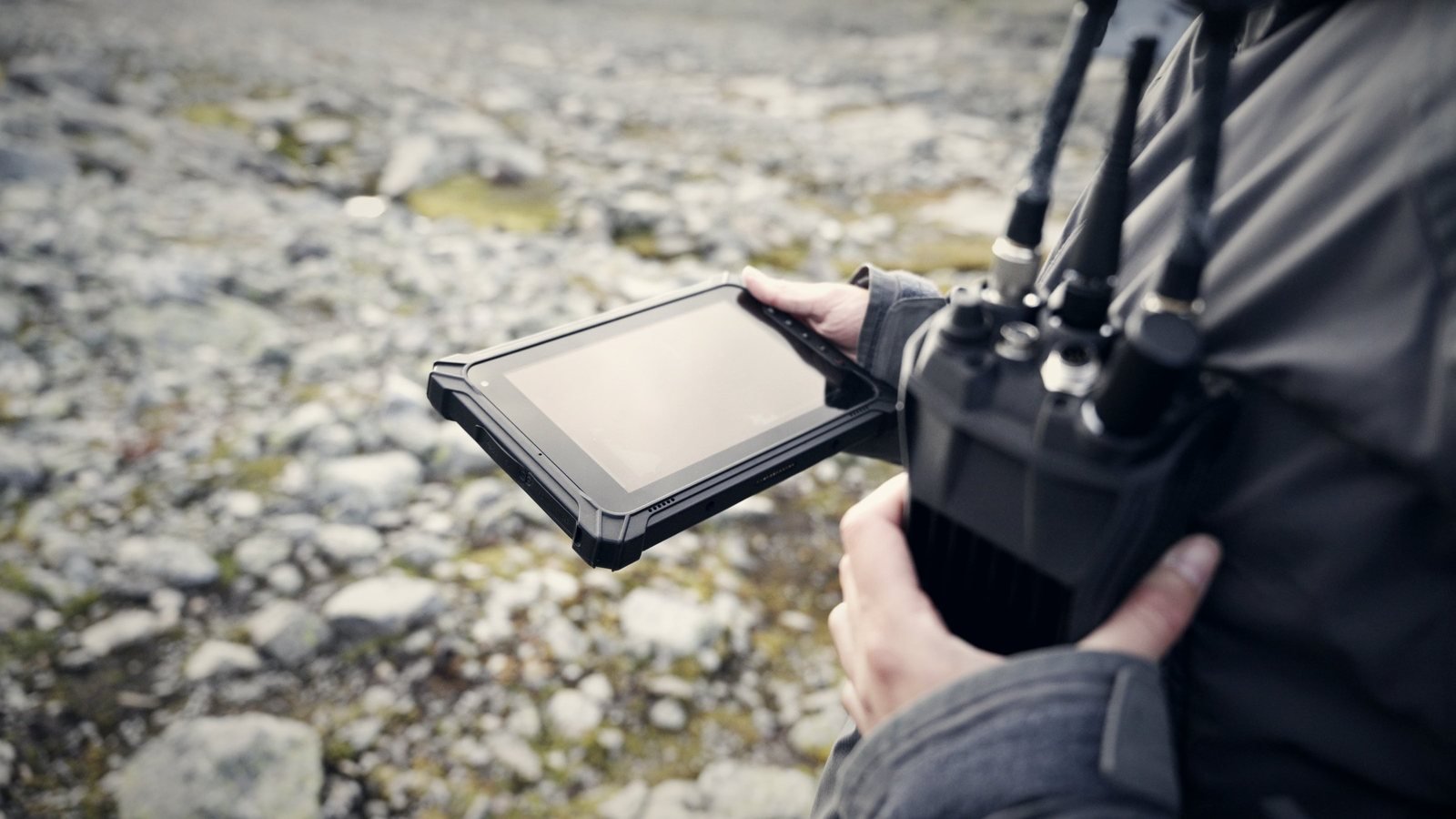
Operator holding a rugged tablet with a multi-antenna radio on the chest
Rugged tablet and MANET radio carried by the operator, Norway field test.
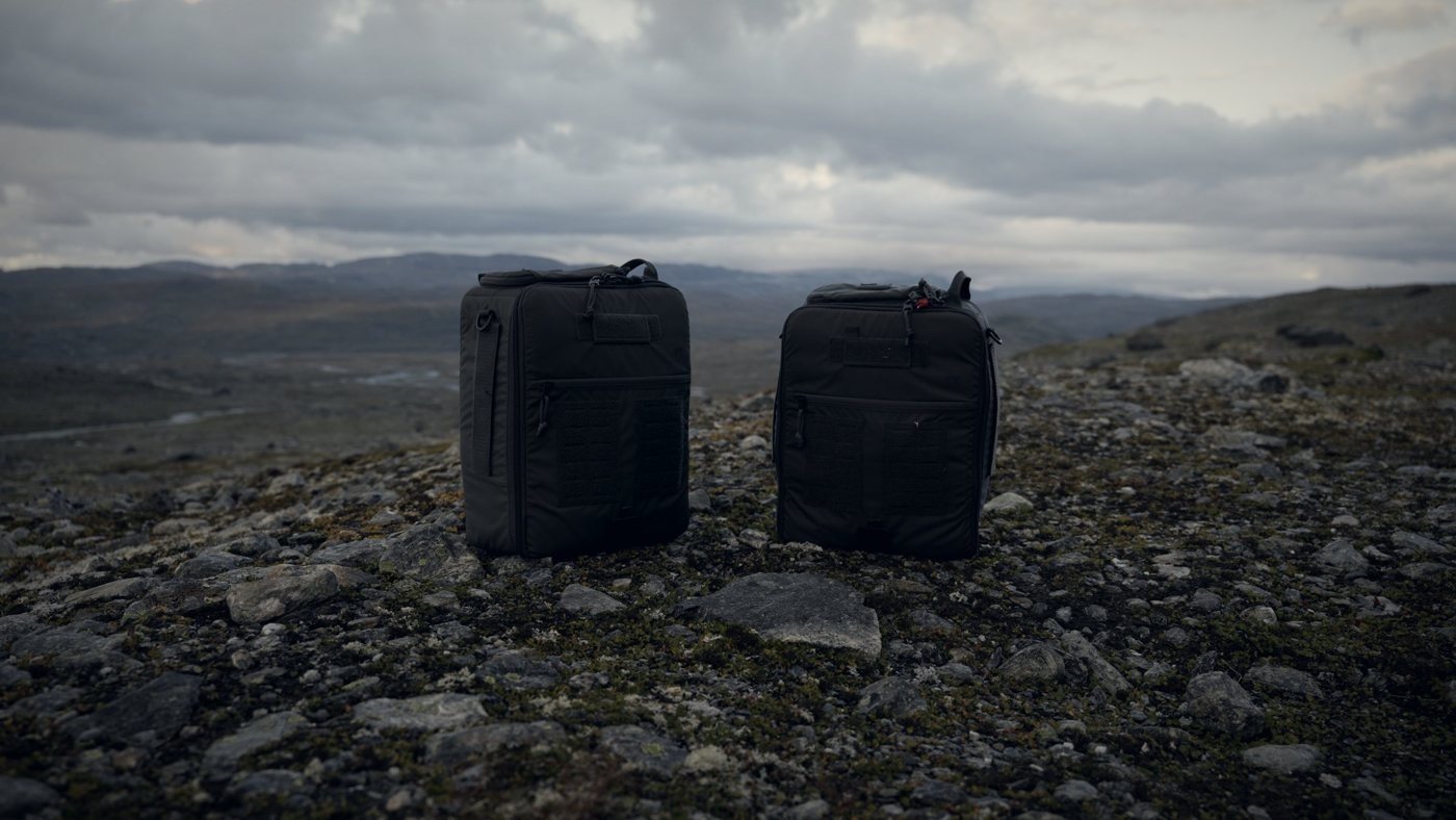
Two black equipment backpacks on rocky ground in the Norwegian mountains
Equipment backpacks at the Norway field test.

Self-healing mesh

MorosX MX88 MANET radios: every node is a relay, routing re-optimises around losses, vehicles and foot teams stay connected. ATAK / TAK ready.

Sovereign by default

End-to-end encryption, GDPR-compliant patient handling, offline-capable local storage and no dependency on non-EU cloud.

05 · Rapid network expansion

Grow the network fast with low-cost nodes.

The core mesh can be extended with inexpensive radios. Drones carry and deploy Meshtastic nodes into areas no vehicle or team can reach yet, so coverage grows in minutes, not days.

Drone-deployed Meshtastic nodes

Low-cost nodes placed from the air extend the network into damaged or cut-off areas.

Cheap to scale

Many inexpensive nodes add reach and redundancy without the cost of more tactical radios.

One network

Extended coverage feeds into the same Mission Control picture as the tactical mesh and the satellite uplink.

06 · Origin

Proven where there is nothing.

RNS Mission Control started on an expedition to Antarctica. Kai Müller and the team that ran it needed clinical-grade telemedicine on a continent without infrastructure, so they built it, took it south and proved it worked. The results were published in Military Medicine in December 2024.

Today Kai Müller leads RNS Europe as managing director, and the platform has grown from a single telemedicine link into a full command-and-coordination system.

“Connecting the Unreachable” · Military Medicine · Dec 2024
Field test · Norway

Tested in the field, not in a lab.

Laptops, patient monitors, drones and radios running together in the mountains, with expedition-medicine scenarios as the workload.

Field camp with two tents, a patient in a bivouac sack and an operator working on a laptop
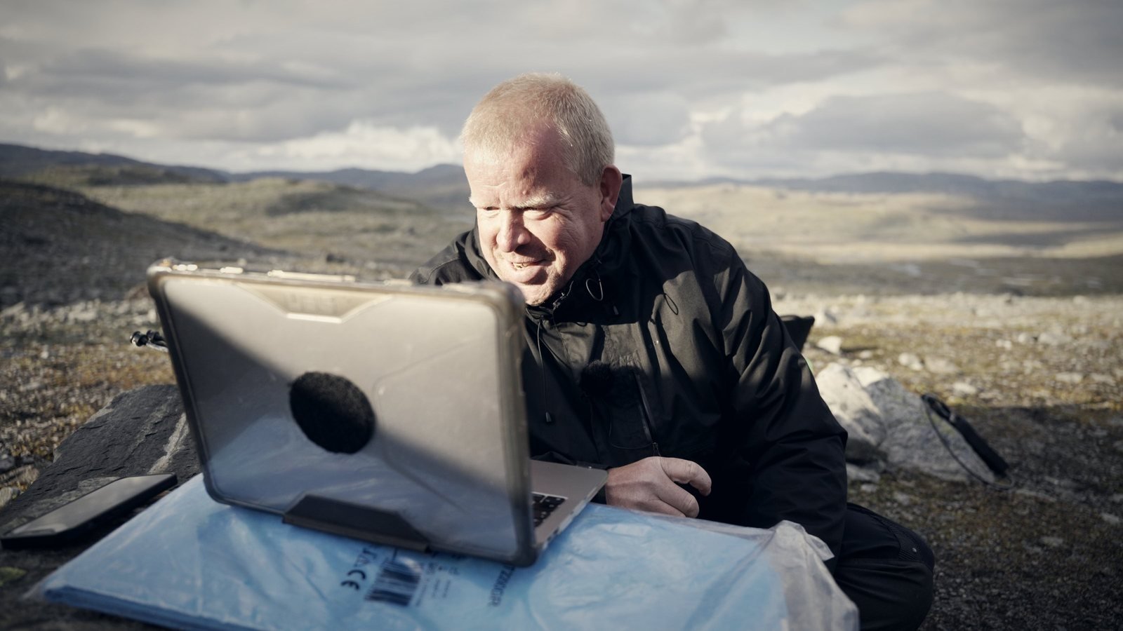
Operator using a laptop at the field camp
Mission Control on a laptop at the field camp.
Laptop showing the patient picture next to a patient in a bivouac sack
The patient picture on screen, next to the patient.
Mindray patient monitor on rocky ground with cables
Mindray patient monitor feeding vitals into the system.
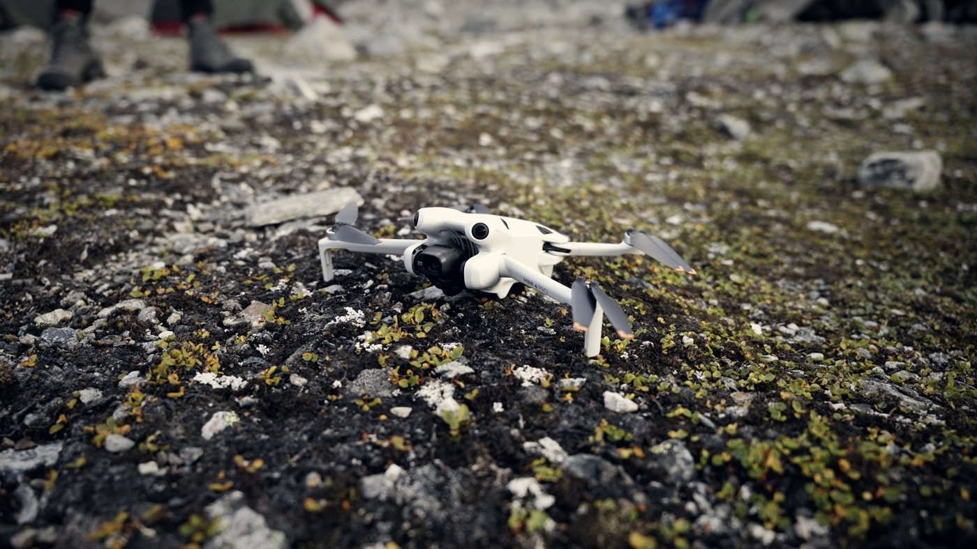
Small drone on the ground at the Norway field camp
Small drone on the ground, ready for damage verification.
Two responders caring for a casualty in a bivouac sack on a glacier
Casualty care scenario on a glacier.
Working with
NATO CIMIC Centre of Excellence
Remote Area Risk International
Powerfilm Solar
MorosX
Bayern Innovativ TechHUB Sicherheit & Verteidigung
07 · Contact

Responsible for cross-border response? Let us show you the picture.

Civil protection, critical-infrastructure resilience, civil–military interoperability, NGO field operations: we work with responders across the EU and NATO ecosystem.

Protected against spam and automated abuse.